Weather and snow report
Weather in South Tyrol
Last update: 20.10.2026, 11:00
Today's weather
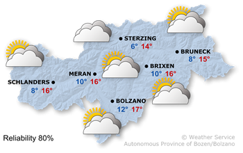
A low-pressure system over Western Europe will determine the weather with moist air masses from the south.
Clouds will dominate, with only few sunny spells. During the day, there will be at most a few scattered showers. Overnight, rainfall will become more frequent, starting from the south.
Decreasing maximum temperatures, ranging from 14° to 17°.
Tomorrow's weather
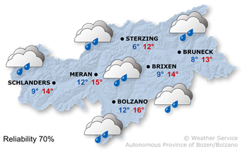
A low-pressure system is causing unsettled weather. A cold front will move across the Alps during the night leading into Thursday.
It is often overcast. In the early morning and during the morning, there will be widespread rain. Later on, dry spells will alternate with showers moving in from the south. During the following night, the snow line will drop to between 1500 and 1800 m.
In the morning, temperatures range between 6° and 12°, whilst during the day they range between 12° and 16°.
Further development

17°/-2°
Thursday, 22.10
16°/-2°
Friday, 23.10

15°/-2°
Saturday, 24.10

13°/-2°
Sunday, 25.10
On Thursday, the weather will improve as a northerly foehn wind blows in. The rain will move eastwards during the morning, and the sun will subsequently break through from the Vinschgau Valley.
Friday will be quite sunny, with a few clouds passing through at times.
On Saturday, clouds will predominate and a few rain showers are expected, particularly in the first half of the day.
Sunday is expected to bring partly cloudy weather with very little sunshine.
Today's mountain weather
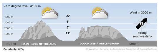
Lots of clouds
Clouds and fog often severely restrict visibility, making it difficult for the sun to break through. During the day, there will be at most a few scattered showers; during the night leading into Wednesday, rain will spread in from the south.
High wind
1 - light wind
5 - 15 km/h
2 - moderate wind
16 - 30 km/h
3 - strong wind
31 - 60 km/h
Tomorrow's mountain weather
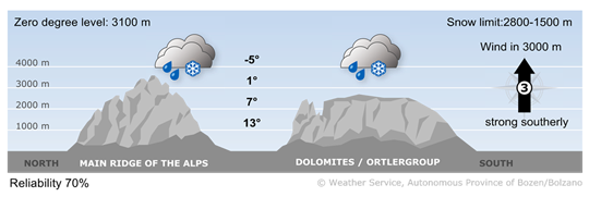
Gloomy and wet
It is mostly overcast, with frequent showers, some of which are heavy. During the day, snow falls only in the high mountains above 2.600–2.800 m. As the cold front passes through, the snow line will drop to 1.500 m overnight. Strong southerly winds will blow at higher altitudes; as the night progresses, strong northerly winds will pick up in many places and temperatures will fall significantly.
High wind
1 - light wind
5 - 15 km/h
2 - moderate wind
16 - 30 km/h
3 - strong wind
31 - 60 km/h

 Roter Hahn